Pharmacy nearby مركز الحمراء الطبي
Jordan
Pharmacy nearby مركز الحمراء الطبي
مركز الحمراء الطبي
شارع السينما،،، Irbid, ירדן
contacts phone
:
+962
Latitude:
32.5569556
, Longitude:
35.8479094
larger map & directions
read more
nearest Pharmacy
131 m
الجامع الكبير
Khalaf At-Tall Street, Irbid
Pharmacy
read more
229 m
saadoun pharmacy
Irbid
Pharmacy
read more
297 m
Shifa pharmacy
Umar Bin Al Khatab, Irbid
Pharmacy
read more
335 m
modern pharmacy -Irbidالصيدلية الحديثة - اربد
شارع عمر بن الخطاب, Irbid
Pharmacy
read more
337 m
صيدلية بلاد الشام البيطرية
King Faysal I Street, Irbid
Pharmacy
read more
341 m
Al-Haditha Pharamcy الصيدلية الحديثة - اربد
Omar Bin Al-Khattab street-Jordanشارع عمر بن الخطاب, Irbid
Pharmacy
read more
348 m
Modern pharmacy - Irbid
Irbid
Pharmacy
read more
364 m
Dawacom Pharmacy
Unnamed Road, Irbid
Pharmacy
read more
376 m
Egyptian Pharmacy
Irbid
Pharmacy
read more
383 m
صيدلية المغايرة
Irbid
Pharmacy
read more
402 m
مؤسسة هضاب للادوية البيطرية
Elhamy Street, Irbid
Pharmacy
read more
409 m
صيدلية الرازي
Irbid
Pharmacy
read more
729 m
Pharmacy Irbid camp
Hettin Street, Irbid
Pharmacy
read more
732 m
Alhaitham Pharmacy
Hettin Street, Irbid
Pharmacy
read more
798 m
Pharmacy Uvreuran
Irbid
Pharmacy
read more
849 m
صيدلية سفيان السكجي
Irbid
Pharmacy
read more
891 m
صيدلية وضاح
Irbid
Pharmacy
read more
891 m
صيدلية الحياة
Irbid
Pharmacy
read more
893 m
Wadah Pharmacy
Irbid
Pharmacy
read more
905 m
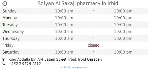
Sofyan Al Sakaji pharmacy
King Abdulla Bin Al-Hussain Street, Irbid
Pharmacy
read more
970 m
Shehab Pharmacy
Balat Al-Shuhadaa Street, Irbid
Pharmacy
read more
986 m
صيدلية
Irbid
Pharmacy
read more
1.109 km
صيدلية نبيه النابلسي
إربد،
Pharmacy
read more
1.163 km
صيدلية ذات النطاقين
Al-Fidaa Street, Irbid
Pharmacy
read more
2.185 km
صيدليه ايقاع Eqaa Pharmacy
Irbid
Pharmacy
read more
📑
all categories
Accounting
Administrative area level 1
Administrative area level 2
Airport
Amusement park
Aquarium
Art gallery
Atm
Bakery
Bank
Bar
Beauty salon
Bicycle store
Book store
Bowling alley
Bus station
Cafe
Campground
Car dealer
Car rental
Car repair
Car wash
Cemetery
Church
City hall
Clothing store
Colloquial area
Convenience store
Country
Courthouse
Dentist
Department store
Doctor
Electrician
Electronics store
Embassy
Finance
Fire station
Florist
Food
Funeral home
Furniture store
Gas station
General contractor
Grocery or supermarket
Gym
Hair care
Hardware store
Health
Home goods store
Hospital
Insurance agency
Jewelry store
Laundry
Lawyer
Library
Liquor store
Local government office
Locality
Locksmith
Lodging
Meal delivery
Meal takeaway
Mosque
Movie rental
Movie theater
Moving company
Museum
Natural feature
Neighborhood
Night club
Painter
Park
Parking
Pet store
Pharmacy
Physiotherapist
Place of worship
Plumber
Point of interest
Police
Post office
Premise
Real estate agency
Restaurant
Route
Rv park, camping
School
Shoe store
Shopping mall
Spa
Stadium
Storage
Store
Supermarket
Taxi stand
Train station
Travel agency
University
Veterinary care
Zoo
sublocality level 1
↑