Restaurant nearby Saj
Coronavirus disease (COVID-19) Situation
confirmed cases
1746997
deaths
14122
Jordan
Restaurant nearby Saj
Saj
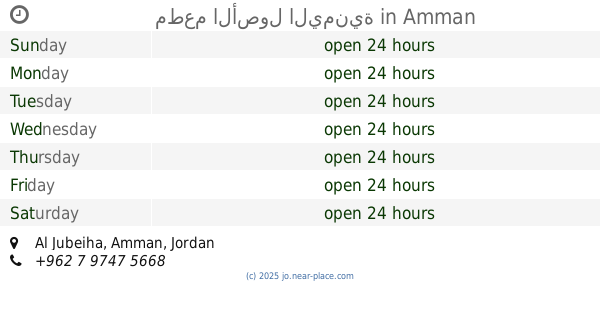
Al Jubeiha, Amman, Jordan
contacts phone
:
+962 6 566 0880
website:
www.facebook.com
Latitude:
32.0128915
, Longitude:
35.8775106
larger map & directions
read more
nearest Restaurant
12 m
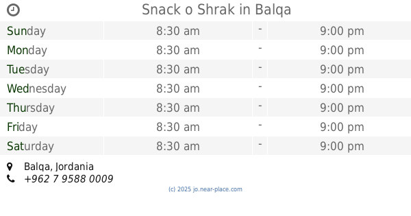
Snack o Shrak
Balqa
Restaurant
read more
20 m
Le Saj Uni
Balqa
Restaurant
read more
199 m
Mashroo7a
Khalil As-Saket Street, Amman
Restaurant
read more
225 m
مطعم مشروحة
ضاحية الرشيد، ش. خليل الساكت، عمّان،
Restaurant
read more
517 m
مطعم حمادة
Akef Al Fayez, Amman
Restaurant
read more
526 m
HAB BURGER
Amman
Restaurant
read more
528 m
مطعم تلال الضاحية
Al Jama'a, Amman
Restaurant
read more
579 m
ميلك بار
Balqa
Restaurant
read more
726 m
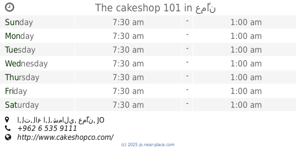
The cakeshop 101
التلاع الشمالي، عمّان
Restaurant
read more
772 m
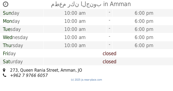
مطعم ركن الجنوب
Queen Rania Street 273, Amman
Restaurant
read more
774 m
Hashtag Saj
Amman
Restaurant
read more
781 m
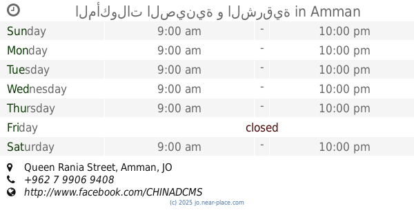
المأكولات الصينية و الشرقية
Queen Rania Street, Amman
Restaurant
read more
786 m
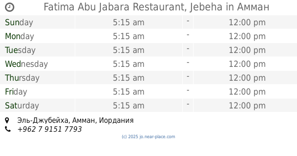
Fatima Abu Jabara Restaurant, Jebeha
Amman
Restaurant
read more
787 m
米线约旦
Queen Rania Street 273, Amman
Restaurant
read more
805 m
مطعم عالية
Queen Rania Street 273, Amman
Restaurant
read more
902 m
Sweileh Gate Restaurant
Queen Rania Street, Amman
Restaurant
read more
971 m
Frisco Baldi
Al Wifaq, Amman
Restaurant
read more
977 m
Karaz Box Caffe
Queen Rania Street 281, Amman
Restaurant
read more
1.108 km
ملك الطاووق
Amman
Restaurant
read more
1.126 km
Ones Pizza & Lebanese Pastery
Amman
Restaurant
read more
1.149 km
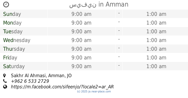
سيفين
Sakhr Al Ahmasi, Amman
Restaurant
read more
1.167 km
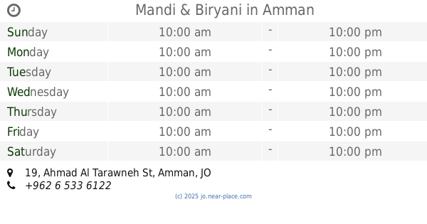
Mandi & Biryani
Saed Al Lawzi Complex, Ahmad Al Tarawneh St 19, Amman
Restaurant
read more
1.17 km
مطعم باب اليمن السعيد
Amman
Restaurant
read more
1.19 km
Little Caesars Pizza
Amman
Restaurant
read more
1.237 km
مطعم الأصول اليمنية
Amman
Restaurant
read more
📑
all categories
Accounting
Administrative area level 1
Administrative area level 2
Airport
Amusement park
Aquarium
Art gallery
Atm
Bakery
Bank
Bar
Beauty salon
Bicycle store
Book store
Bowling alley
Bus station
Cafe
Campground
Car dealer
Car rental
Car repair
Car wash
Cemetery
Church
City hall
Clothing store
Colloquial area
Convenience store
Country
Courthouse
Dentist
Department store
Doctor
Electrician
Electronics store
Embassy
Finance
Fire station
Florist
Food
Funeral home
Furniture store
Gas station
General contractor
Grocery or supermarket
Gym
Hair care
Hardware store
Health
Home goods store
Hospital
Insurance agency
Jewelry store
Laundry
Lawyer
Library
Liquor store
Local government office
Locality
Locksmith
Lodging
Meal delivery
Meal takeaway
Mosque
Movie rental
Movie theater
Moving company
Museum
Natural feature
Neighborhood
Night club
Painter
Park
Parking
Pet store
Pharmacy
Physiotherapist
Place of worship
Plumber
Point of interest
Police
Post office
Premise
Real estate agency
Restaurant
Route
Rv park, camping
School
Shoe store
Shopping mall
Spa
Stadium
Storage
Store
Supermarket
Taxi stand
Train station
Travel agency
University
Veterinary care
Zoo
sublocality level 1
↑