Restaurant nearby مطعم رائحة الياسمين
Jordan
Restaurant nearby مطعم رائحة الياسمين
مطعم رائحة الياسمين
الحمرانية،, Amman Israel
contacts phone
:
+962
Latitude:
31.9184838
, Longitude:
35.8992692
read more
nearest Restaurant
373 m
Arabi Turkey Restaurant
Sokarieh Commercial Complex, Al Quds St 364, Amman
Restaurant
read more
439 m
ملحمة النعيمي
Amman
Restaurant
read more
448 m
Hamada Restaurant
Complex No 1, Jabal Arafat Street 1, Amman
Restaurant
read more
452 m
Shawerma Abu Karam
Amman
Restaurant
read more
471 m
معجنات الأيام الشامية 2
Amman
Restaurant
read more
485 m
مطعم النعيمي الرئيسيي
Amman
Restaurant
read more
558 m
Restaurants Sultan
Amman
Restaurant
read more
558 m
الكلحة Kalha
Amman
Restaurant
read more
587 m
Arab Restaurant
Amman
Restaurant
read more
589 m
مطبخ النرجس للتواصي
Alyasmeen, Shura St., Amman
Restaurant
read more
619 m
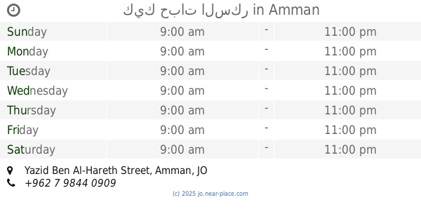
كيك حبات السكر
Yazid Ben Al-Hareth Street, Amman
Restaurant
read more
671 m
شاورما الهنيني
Amman
Restaurant
read more
675 m
il Forno
Jabal Arafat Street, Amman
Restaurant
read more
700 m
شاورما عبق الياسمين
Al-Shura Street, Amman
Restaurant
read more
720 m
مطعم زاد الياسمين
Jabal Arafat Street 43, Amman
Restaurant
read more
741 m
Ghazal Restaurants
Amman
Restaurant
read more
750 m
القيصر الصغير الياسمين
Jabal Arafat Street, Amman
Restaurant
read more
819 m
مطعم حماده
Amman
Restaurant
read more
829 m
Gahat Kitchen
Amman
Restaurant
read more
831 m
AL MIDYAF CATERING
Complex No 18, Abdullah Al Drami St 18, Amman
Restaurant
read more
840 m
مطعم شاطي غزة للاسماك الطازجة والمجمدة
الياسمين،, Amman
Restaurant
read more
879 m
مطعم أصول الإبداع
Al Yasmin, Amman
Restaurant
read more
907 m
Al Kaf Al Thahabi Restaurant
Complex No 22, Al Nabeghah Al Jadi St 22, Amman
Restaurant
read more
1.011 km
مطعم شكري ابو جبارة
Ad-Dustour Street 213, Amman
Restaurant
read more
1.102 km
معجنات الشامي
Ad-Dustour Street, Amman
Restaurant
read more
📑
all categories
Accounting
Administrative area level 1
Administrative area level 2
Airport
Amusement park
Aquarium
Art gallery
Atm
Bakery
Bank
Bar
Beauty salon
Bicycle store
Book store
Bowling alley
Bus station
Cafe
Campground
Car dealer
Car rental
Car repair
Car wash
Cemetery
Church
City hall
Clothing store
Colloquial area
Convenience store
Country
Courthouse
Dentist
Department store
Doctor
Electrician
Electronics store
Embassy
Finance
Fire station
Florist
Food
Funeral home
Furniture store
Gas station
General contractor
Grocery or supermarket
Gym
Hair care
Hardware store
Health
Home goods store
Hospital
Insurance agency
Jewelry store
Laundry
Lawyer
Library
Liquor store
Local government office
Locality
Locksmith
Lodging
Meal delivery
Meal takeaway
Mosque
Movie rental
Movie theater
Moving company
Museum
Natural feature
Neighborhood
Night club
Painter
Park
Parking
Pet store
Pharmacy
Physiotherapist
Place of worship
Plumber
Point of interest
Police
Post office
Premise
Real estate agency
Restaurant
Route
Rv park, camping
School
Shoe store
Shopping mall
Spa
Stadium
Storage
Store
Supermarket
Taxi stand
Train station
Travel agency
University
Veterinary care
Zoo
sublocality level 1
↑