Restaurant nearby Amartigh Restaurant
Jordan
Restaurant nearby Amartigh Restaurant
Amartigh Restaurant
Gobernación de Ma'an, Jordania
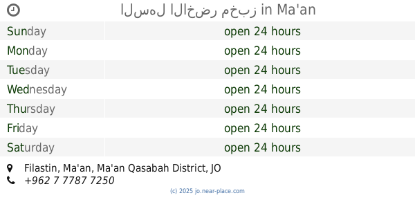
contacts phone
:
+962
Latitude:
30.0930956
, Longitude:
35.5211625
larger map & directions
read more
nearest Restaurant
896 m
مطعم المهباش
Restaurant
read more
17.867 km
Baraka Restaurant
Restaurant
read more
21.664 km
Paradise Restaurant
Ma'an
Restaurant
read more
22.709 km
مطعم ومسمكة الدب
Ma'an
Restaurant
read more
22.758 km
The dessert cafe bazsar
Restaurant
read more
22.852 km
فندق تبوك
Maan Al-Jadid, Ma'an
Restaurant
read more
22.878 km
مطعم جمره
شارع الاشغال العامه
Restaurant
read more
23.106 km
امبراطوريه محمد كريشان
Ma'an
Restaurant
read more
23.23 km
مطعم جرة الخير
Palestine Street, Ma'an
Restaurant
read more
23.251 km
مطعم العنود
Palestine Street, Ma'an
Restaurant
read more
23.286 km
صالة ومطعم حمودة
Filastin, Ma'an
Restaurant
read more
23.315 km
حميمة للخضار والفاكة
Maan Al-Jadid, Ma'an
Restaurant
read more
23.324 km
Abu Stayf Restaurant
Al-Bayarah Street, Ma'an
Restaurant
read more
23.359 km
كفتيرياء السرايا
Maan Al-Jadid, Ma'an
Restaurant
read more
23.365 km
سجى للخضرا والفواكه
Al-Jamia, Ma'an
Restaurant
read more
23.387 km
فانوس الضيعه
الجامعة، معان
Restaurant
read more
23.391 km
مطعم فانوس الضيعه
الجامعة، معان
Restaurant
read more
23.392 km
السهل الاخضر مخبز
Filastin, Ma'an
Restaurant
read more
23.41 km
مطعم جوهرة القيصر
Abu Sufyan Street, Ma'an
Restaurant
read more
23.457 km
Hadramot Restaurant
Maan Shobak Road, Ma'an
Restaurant
read more
23.466 km
مطعم السلطان
شارع فلسطين, مقابل حلويات العفوري, Ma'an
Restaurant
read more
23.485 km
Yemen Palace Mandi
معان, الجامعة حي عليان, Ma'an
Restaurant
read more
23.527 km
Aquarium restaurant Bear for Fresh Fish
King Hussein Street, Ma'an
Restaurant
read more
23.598 km
مطعم المملكة
Unnamed Road, Ma'an
Restaurant
read more
24.711 km
كفاتيريا الجامعة
Ma'an
Restaurant
read more
📑
all categories
Accounting
Administrative area level 1
Administrative area level 2
Airport
Amusement park
Aquarium
Art gallery
Atm
Bakery
Bank
Bar
Beauty salon
Bicycle store
Book store
Bowling alley
Bus station
Cafe
Campground
Car dealer
Car rental
Car repair
Car wash
Cemetery
Church
City hall
Clothing store
Colloquial area
Convenience store
Country
Courthouse
Dentist
Department store
Doctor
Electrician
Electronics store
Embassy
Finance
Fire station
Florist
Food
Funeral home
Furniture store
Gas station
General contractor
Grocery or supermarket
Gym
Hair care
Hardware store
Health
Home goods store
Hospital
Insurance agency
Jewelry store
Laundry
Lawyer
Library
Liquor store
Local government office
Locality
Locksmith
Lodging
Meal delivery
Meal takeaway
Mosque
Movie rental
Movie theater
Moving company
Museum
Natural feature
Neighborhood
Night club
Painter
Park
Parking
Pet store
Pharmacy
Physiotherapist
Place of worship
Plumber
Point of interest
Police
Post office
Premise
Real estate agency
Restaurant
Route
Rv park, camping
School
Shoe store
Shopping mall
Spa
Stadium
Storage
Store
Supermarket
Taxi stand
Train station
Travel agency
University
Veterinary care
Zoo
sublocality level 1
↑