Mosque nearby Salah al-Din Mosque
Jordan
Mosque nearby Salah al-Din Mosque
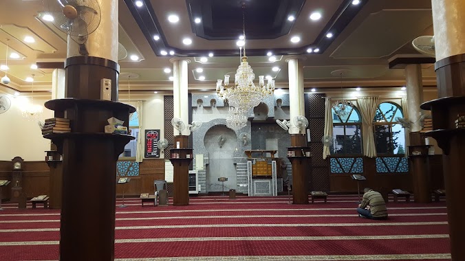
Salah al-Din Mosque
19, Ibrahim Ayoub Street, Amman, JO Иордания
contacts phone
:
+962 7 9844 8263
Latitude:
31.9555497
, Longitude:
35.8937116
larger map & directions
read more
nearest Mosque
877 m
Prince Hassan Mosque
Amman
Mosque
read more
908 m
Suleiman Haj Salem Mosque
Amman
Mosque
read more
965 m
Abu Bakr Siddiq Mosque
Amman
Mosque
read more
1.21 km
Sayeda Aisha Mosque
Amman
Mosque
read more
1.383 km
مسجد الفاروق
Ali Mesmar Street, Amman
Mosque
read more
1.424 km
مسجد الدفاع المدني
Amman
Mosque
read more
1.633 km
Hudhayfah ibn al-Yaman Mosque
Amman
Mosque
read more
1.747 km
مسجد امين خليل الراوي
Abdul Muttaleb Street, Amman
Mosque
read more
1.757 km
Fayhaa mosque
Amman
Mosque
read more
1.764 km
Al Fayha Mosque مسجد الفيحاء
Shumaisani, Amman
Mosque
read more
1.794 km
Habiba Mahmoud Mosque
Amman
Mosque
read more
1.797 km
مسجد أهل الخير
Amman
Mosque
read more
1.851 km
Hassan al-Banna mosque
Amman
Mosque
read more
1.916 km
Zentralmoschee Amman
Amman
Mosque
read more
1.916 km
Мечеть короля Абдаллы I
Amman
Mosque
read more
1.996 km
مسجد ابراهيم الخليل
Ibn Bassam Street 23, Amman
Mosque
read more
2.016 km
Homsi Mosque
Amman
Mosque
read more
2.235 km
مسجد الرملة البيضاء
Amman
Mosque
read more
2.297 km
Abu Ayyub al-Ansari
مسجد بهيه الخليلي, Amman
Mosque
read more
2.317 km
Sido Al Kurdi Mosque
Amman
Mosque
read more
2.394 km
مسجد عمر
Shukri Al-Quwatli Street 35،, Amman
Mosque
read more
2.505 km
ماجدة عمان . عرجان . مسجد خالد بن الوليد
Aarjan Street, Amman
Mosque
read more
2.574 km
Bin Saad Al-Bashir
Amman
Mosque
read more
2.644 km
مسجد محمد علي سلامة العبيدي
Muhammad Reda Al-Shabibi Street, Amman
Mosque
read more
2.798 km
مسجد الفضل بن عباس
Amman
Mosque
read more
📑
all categories
Accounting
Administrative area level 1
Administrative area level 2
Airport
Amusement park
Aquarium
Art gallery
Atm
Bakery
Bank
Bar
Beauty salon
Bicycle store
Book store
Bowling alley
Bus station
Cafe
Campground
Car dealer
Car rental
Car repair
Car wash
Cemetery
Church
City hall
Clothing store
Colloquial area
Convenience store
Country
Courthouse
Dentist
Department store
Doctor
Electrician
Electronics store
Embassy
Finance
Fire station
Florist
Food
Funeral home
Furniture store
Gas station
General contractor
Grocery or supermarket
Gym
Hair care
Hardware store
Health
Home goods store
Hospital
Insurance agency
Jewelry store
Laundry
Lawyer
Library
Liquor store
Local government office
Locality
Locksmith
Lodging
Meal delivery
Meal takeaway
Mosque
Movie rental
Movie theater
Moving company
Museum
Natural feature
Neighborhood
Night club
Painter
Park
Parking
Pet store
Pharmacy
Physiotherapist
Place of worship
Plumber
Point of interest
Police
Post office
Premise
Real estate agency
Restaurant
Route
Rv park, camping
School
Shoe store
Shopping mall
Spa
Stadium
Storage
Store
Supermarket
Taxi stand
Train station
Travel agency
University
Veterinary care
Zoo
sublocality level 1
↑