Mosque nearby Aisha mosque
Jordan
Mosque nearby Aisha mosque
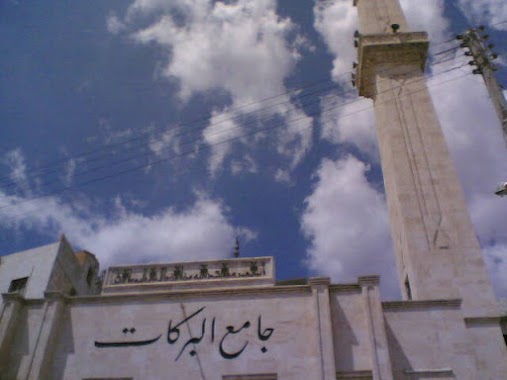
Aisha mosque
Na'ur, Amman, ירדן
contacts phone
:
+962
Latitude:
31.8427607
, Longitude:
35.832276
larger map & directions
read more
nearest Mosque
653 m
المسجد العمري
منطقة ناعور،, Amman
Mosque
read more
1.12 km
مسجد الحاج صبري فراج
Amman
Mosque
read more
3.039 km
Al-Falah Mosque and Inshirah
Amman
Mosque
read more
3.153 km
مسجد السلام
Dead Sea Road, Amman
Mosque
read more
3.217 km
Tamim Bin Dari mosque
Amman
Mosque
read more
3.288 km
Housing Radwan Mosque
Amman
Mosque
read more
3.289 km
مسجد ابن حجر العسقلاني
Hizam Ring Road, Amman
Mosque
read more
3.392 km
مسجد الهيثم الادلبي
Amman
Mosque
read more
3.63 km
مسجد الهداية
Amman
Mosque
read more
3.638 km
مسجد الهداية/حسبان
Madaba Highway, Amman
Mosque
read more
3.725 km
مسجد حمزة بن عبد المطلب
Amman
Mosque
read more
3.793 km
Barakat Mosque
Amman
Mosque
read more
3.811 km
Nau'r Big Mosque
Amman
Mosque
read more
3.848 km
مسجد الرسالة
Dead Sea Road, Amman
Mosque
read more
4.014 km
مسجد الريان al-rayyan mosque
Amman
Mosque
read more
4.05 km
Rabia Mosque and Abd al-Karim al-Khatib
Amman
Mosque
read more
4.165 km
مسجد خديجة رضي الله عنها
Hizam Ring Road, Amman
Mosque
read more
4.206 km
Khalil al-Rahman Mosque
Amman
Mosque
read more
4.284 km
Silwan Mosque
Amman
Mosque
read more
4.395 km
مسجد الطباع
Amman
Mosque
read more
4.635 km
Mosque honoring one's parents
Amman
Mosque
read more
5.124 km
مسجد عبادة ابن صامت
Amman
Mosque
read more
5.306 km
Al-Marzouk Mosque
Amman
Mosque
read more
5.573 km
Rahma Mosque
Amman
Mosque
read more
5.574 km
مسجد الرحمة
Amman
Mosque
read more
📑
all categories
Accounting
Administrative area level 1
Administrative area level 2
Airport
Amusement park
Aquarium
Art gallery
Atm
Bakery
Bank
Bar
Beauty salon
Bicycle store
Book store
Bowling alley
Bus station
Cafe
Campground
Car dealer
Car rental
Car repair
Car wash
Cemetery
Church
City hall
Clothing store
Colloquial area
Convenience store
Country
Courthouse
Dentist
Department store
Doctor
Electrician
Electronics store
Embassy
Finance
Fire station
Florist
Food
Funeral home
Furniture store
Gas station
General contractor
Grocery or supermarket
Gym
Hair care
Hardware store
Health
Home goods store
Hospital
Insurance agency
Jewelry store
Laundry
Lawyer
Library
Liquor store
Local government office
Locality
Locksmith
Lodging
Meal delivery
Meal takeaway
Mosque
Movie rental
Movie theater
Moving company
Museum
Natural feature
Neighborhood
Night club
Painter
Park
Parking
Pet store
Pharmacy
Physiotherapist
Place of worship
Plumber
Point of interest
Police
Post office
Premise
Real estate agency
Restaurant
Route
Rv park, camping
School
Shoe store
Shopping mall
Spa
Stadium
Storage
Store
Supermarket
Taxi stand
Train station
Travel agency
University
Veterinary care
Zoo
sublocality level 1
↑