Gas station nearby Total Petrol stations
Jordan
Gas station nearby Total Petrol stations
Total Petrol stations
Al-Mafraq Израиль
contacts phone
:
+962
Latitude:
32.3424539
, Longitude:
36.1873448
read more
nearest Gas station
1.38 km
Total Quartz Abu Olaim - ابو عليم
32.3286111, 36.21472222222223
Gas station
read more
1.381 km
محطة توليد كهرباء رحاب
20, Al-Mafraq
Gas station
read more
1.788 km
Sultan station
Al-Mafraq
Gas station
read more
1.867 km
Gulf
Al-Mafraq
Gas station
read more
2.291 km
Gulf
Hisham Bin Abd Al-Malik, Al-Mafraq
Gas station
read more
2.353 km
محطة محروقات جوبترول الاردنية
Al-Mafraq
Gas station
read more
2.969 km
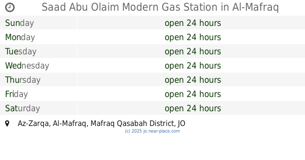
Saad Abu Olaim Modern Gas Station
Az-Zarqa, Al-Mafraq
Gas station
read more
4.947 km
Manaseer Gas Station
15, Al-Mafraq
Gas station
read more
5.348 km
Total Petrol Station 4 Mafraq
الغدير الأخضر،, Al-Mafraq
Gas station
read more
6.151 km
محطة المفرق للمحروقات
Gas station
read more
7.339 km
Manaseer Fuel Station
خط الشام, Al-Mafraq
Gas station
read more
7.361 km
Saadi station
10
Gas station
read more
9.245 km
Jopetrol Gas Station
مثلث الباعج
Gas station
read more
13.071 km
محطة العساف لخدمة السيارات
Gas station
read more
13.178 km
Gazi Gas Staion
Gas station
read more
14.246 km
Petrol station
Mugayyir as-Sirhan
Gas station
read more
14.288 km
محطه الرقيبات للبناشر
Gas station
read more
14.975 km
Gas station Sama Al Sarhan
Sama as-Sirhan
Gas station
read more
18.215 km
Arafat Gas Station
Gas station
read more
22.9 km
Petrol Station محطة طبريا للمحروقات
Gas station
read more
23.534 km
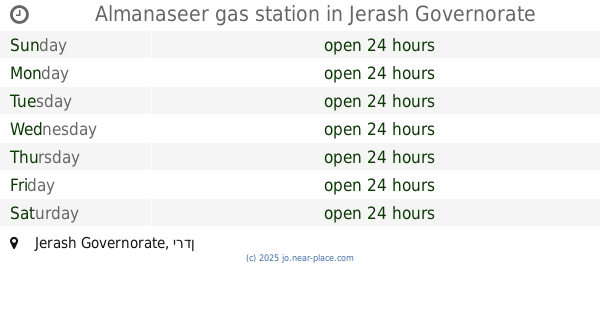
Almanaseer gas station
Gas station
read more
23.622 km
Al-Zyoud Gas Station
Gas station
read more
26.899 km
كازية الحسبان alhosban gas station
Gas station
read more
27.251 km
Total
Ramtha
Gas station
read more
28.816 km
محطة أردن الحديثة للمحروقات
Ramtha
Gas station
read more
📑
all categories
Accounting
Administrative area level 1
Administrative area level 2
Airport
Amusement park
Aquarium
Art gallery
Atm
Bakery
Bank
Bar
Beauty salon
Bicycle store
Book store
Bowling alley
Bus station
Cafe
Campground
Car dealer
Car rental
Car repair
Car wash
Cemetery
Church
City hall
Clothing store
Colloquial area
Convenience store
Country
Courthouse
Dentist
Department store
Doctor
Electrician
Electronics store
Embassy
Finance
Fire station
Florist
Food
Funeral home
Furniture store
Gas station
General contractor
Grocery or supermarket
Gym
Hair care
Hardware store
Health
Home goods store
Hospital
Insurance agency
Jewelry store
Laundry
Lawyer
Library
Liquor store
Local government office
Locality
Locksmith
Lodging
Meal delivery
Meal takeaway
Mosque
Movie rental
Movie theater
Moving company
Museum
Natural feature
Neighborhood
Night club
Painter
Park
Parking
Pet store
Pharmacy
Physiotherapist
Place of worship
Plumber
Point of interest
Police
Post office
Premise
Real estate agency
Restaurant
Route
Rv park, camping
School
Shoe store
Shopping mall
Spa
Stadium
Storage
Store
Supermarket
Taxi stand
Train station
Travel agency
University
Veterinary care
Zoo
sublocality level 1
↑