Food nearby Crepe Time
Jordan
Food nearby Crepe Time
Crepe Time
Salt Highway, As-Salt, Salt Qasabah District, JO Иордания
contacts phone
:
+962 7 9159 1322
Latitude:
32.0422684
, Longitude:
35.7839912
larger map & directions
read more
nearest Food
5 m
Crepe Time
Salt Highway, Amman
Food
read more
269 m
Al-Sultan Sweets, حلويات السلطان
As-Salt
Food
read more
2.809 km
New Brands Import & Export Co, Ltd
Amman
Food
read more
3.379 km
حلويات مجاهد
As-Salt
Food
read more
3.942 km
حلويات اخو دنيا فرع السلط
ش. الملكة رانيا،, As-Salt
Food
read more
3.95 km
Frisco F&B services
Food
read more
4.104 km
Brazilian Coffee
Queen Rania Street, As-Salt
Food
read more
4.497 km
Shaheen Roastery
Food
read more
5.7 km
Agricultural Polyethylene Film. Manf. Co DAOUDCO شركة مصانع الاغطية الزراعية م.م داودكو
Jerash Highway, Amman
Food
read more
5.851 km
Al Junaidy
Ashour Commercial Complex، Khalid Bin Al Walid St 139، عمّان
Food
read more
5.851 km
مصنع الجنيدي للألبان
Food
read more
9.057 km
مطبخ وحلويات عامر وعمار
Amman
Food
read more
9.333 km
Arab Tower Trading Co
Taha Al Hajjawi Complex, Mecca Al Mukarramah St 240, Amman
Food
read more
9.696 km
Caraz juices and more
Amman
Food
read more
9.737 km
حلويات البيت الدمشقي
al-madinh al-monawara street building 229, Amman
Food
read more
10.849 km
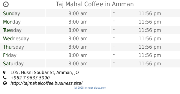
Taj Mahal Coffee
Complex No 105, Husni Soubar St 105, Amman
Food
read more
10.927 km
Craffle
الجندويل،, Amman
Food
read more
11.008 km
Water Anchor
Rashed Buyouk Street, Amman
Food
read more
12.817 km
international center for geotechnical studies (Laboratory)
Amman
Food
read more
14.256 km
Jerashco Clean
Abed Aljawad Hassouna Complex, Khaled Ben Al Walid St, Amman
Food
read more
14.83 km
مزرعة وادي الشتاء للمواشي
Amman
Food
read more
14.899 km
Churro madness
Prince Hashim Bin Al-Hussein Street 66, Amman
Food
read more
17.075 km
afternoon
Al-Rainbow Street, Amman
Food
read more
17.517 km
Habibah Sweets
Complex No 5 5 Al Hashimi St, Amman
Food
read more
19.41 km
سوق الوحدات الشعبي
Amman
Food
read more
📑
all categories
Accounting
Administrative area level 1
Administrative area level 2
Airport
Amusement park
Aquarium
Art gallery
Atm
Bakery
Bank
Bar
Beauty salon
Bicycle store
Book store
Bowling alley
Bus station
Cafe
Campground
Car dealer
Car rental
Car repair
Car wash
Cemetery
Church
City hall
Clothing store
Colloquial area
Convenience store
Country
Courthouse
Dentist
Department store
Doctor
Electrician
Electronics store
Embassy
Finance
Fire station
Florist
Food
Funeral home
Furniture store
Gas station
General contractor
Grocery or supermarket
Gym
Hair care
Hardware store
Health
Home goods store
Hospital
Insurance agency
Jewelry store
Laundry
Lawyer
Library
Liquor store
Local government office
Locality
Locksmith
Lodging
Meal delivery
Meal takeaway
Mosque
Movie rental
Movie theater
Moving company
Museum
Natural feature
Neighborhood
Night club
Painter
Park
Parking
Pet store
Pharmacy
Physiotherapist
Place of worship
Plumber
Point of interest
Police
Post office
Premise
Real estate agency
Restaurant
Route
Rv park, camping
School
Shoe store
Shopping mall
Spa
Stadium
Storage
Store
Supermarket
Taxi stand
Train station
Travel agency
University
Veterinary care
Zoo
sublocality level 1
↑