Bank nearby بنك الاردن دبي الاسلامي
Jordan
Bank nearby بنك الاردن دبي الاسلامي
بنك الاردن دبي الاسلامي
Irbid, Иордания
contacts phone
:
+962
Latitude:
32.5357569
, Longitude:
35.8657654
larger map & directions
read more
nearest Bank
10 m
Jordan Dubai Islamic Bank JDIB
Irbid
Bank
read more
402 m
Bank al Etihad
New Irbid Complex, New Amman Complex, Amman
Bank
read more
421 m
بنك القاهرة عمان
Irbid
Bank
read more
427 m
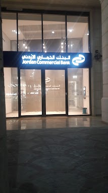
البنك التجاري الاردني .
Irbid
Bank
read more
548 m
DEF Irbid
Irbid
Bank
read more
998 m
البنك العربي
near Thaqafa Circle، شارع الأمير حسن، إربد
Bank
read more
1.026 km
Arab bank
Qasabah District, Irbid
Bank
read more
1.223 km
بنك عَوده
Al Nozha, Irbid
Bank
read more
1.235 km
Jordan Kuwait Bank: Yarmouk University / البنك الأردني الكويتي: جامعة اليرموك
Yarmouk University - Irbid, جامعة اليرموك / اربد, Irbid
Bank
read more
1.266 km
Bank Of Jordan
University Street, Irbid
Bank
read more
1.27 km
بنك الاسكان
شارع الجامعة،, Irbid
Bank
read more
1.276 km
Bank Al Etihad بنك الاتحاد
Irbid
Bank
read more
1.287 km
الضامنون العرب اربد
Feras Al-Ajlouni Street, Irbid
Bank
read more
1.298 km
Arab Bank
Irbid
Bank
read more
1.418 km
Financial Establishment Bank
Shafiq Irshydat, Aydoun
Bank
read more
1.428 km
Zamzam Exchange
Irbid
Bank
read more
1.477 km
شركة الحلبي والكنج للصرافة Al-Halabi and Al-King Company Exchange
شارع عبد القادر التل، دوار الجامعه, Irbid
Bank
read more
1.503 km
Islamic International Arab Bank
Irbid
Bank
read more
1.58 km
Housing Bank
Shafiq Irshydat, Irbid
Bank
read more
1.815 km
JKB: King Abdullah II St/ البنك الأردني الكويتي: فرع شارع الملك عبدالله الثاني
Al-Husson Street, اربد شارع الحصن, Irbid
Bank
read more
1.831 km
ABC Bank Irbid
Irbid
Bank
read more
2 km
مصرف الراجحي Alrajhi bank
Irbid
Bank
read more
2.115 km
بنك الاستثمار العربي الاردني AJIB
King Abdulla Bin Al-Hussain Street, Irbid
Bank
read more
2.125 km
Central Bank
Al Malik Husayn, Irbid
Bank
read more
2.189 km
Bank al Etihad
Irbid,Houson Street, Amman
Bank
read more
📑
all categories
Accounting
Administrative area level 1
Administrative area level 2
Airport
Amusement park
Aquarium
Art gallery
Atm
Bakery
Bank
Bar
Beauty salon
Bicycle store
Book store
Bowling alley
Bus station
Cafe
Campground
Car dealer
Car rental
Car repair
Car wash
Cemetery
Church
City hall
Clothing store
Colloquial area
Convenience store
Country
Courthouse
Dentist
Department store
Doctor
Electrician
Electronics store
Embassy
Finance
Fire station
Florist
Food
Funeral home
Furniture store
Gas station
General contractor
Grocery or supermarket
Gym
Hair care
Hardware store
Health
Home goods store
Hospital
Insurance agency
Jewelry store
Laundry
Lawyer
Library
Liquor store
Local government office
Locality
Locksmith
Lodging
Meal delivery
Meal takeaway
Mosque
Movie rental
Movie theater
Moving company
Museum
Natural feature
Neighborhood
Night club
Painter
Park
Parking
Pet store
Pharmacy
Physiotherapist
Place of worship
Plumber
Point of interest
Police
Post office
Premise
Real estate agency
Restaurant
Route
Rv park, camping
School
Shoe store
Shopping mall
Spa
Stadium
Storage
Store
Supermarket
Taxi stand
Train station
Travel agency
University
Veterinary care
Zoo
sublocality level 1
↑