Supermarket nearby Naklet Jedi minimarket & Café نخلة جدي
Jordan
Supermarket nearby Naklet Jedi minimarket & Café نخلة جدي
Naklet Jedi minimarket & Café نخلة جدي
מחוז בלקא, ירדן
contacts phone
:
+962
Latitude:
31.8938754
, Longitude:
35.5994317
larger map & directions
read more
nearest Supermarket
15.003 km
Batna Stadium
Balqa
Supermarket
read more
15.63 km
اسواق عباد الرحمن
Unnamed Road, As-Salt
Supermarket
read more
19.96 km
Super Market Zoughair
Amman
Supermarket
read more
20.734 km
جوهرة السندباد
Amman
Supermarket
read more
21.525 km
جود البلقاء للخضار والفواكه
As, As-Salt
Supermarket
read more
22.286 km
جزيرة العجائب للهدايا
As-Salt
Supermarket
read more
22.742 km
سوبر ماركت الدجاني
Amman
Supermarket
read more
23.354 km
Carrefour - Al Bayader
Amman
Supermarket
read more
23.414 km
Mazen Abu Al Sondos Grocery
Complex No 70, Abd Al Rahman Al Hussami St 70, Amman
Supermarket
read more
23.739 km
شركة اساس لتجارة قطع غيار السيارت , حموضة ASAS Auto Parts
عمان وادي السير الصناعية , شارع ابو حبة الانصاري, Amman
Supermarket
read more
23.842 km
Essam And Oun Supermarket
Amman
Supermarket
read more
23.879 km
محمص المهباش السلط
30
Supermarket
read more
24.252 km
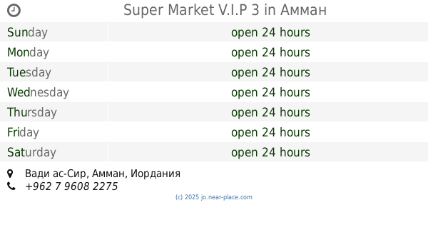
Super Market V.I.P 3
Amman
Supermarket
read more
25.172 km
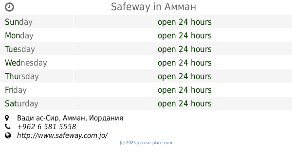
Safeway
Amman
Supermarket
read more
25.707 km
Supermarket AMEER LUTFI
Amman
Supermarket
read more
26.331 km
Amjad Al Balbesy Super Market
Amman
Supermarket
read more
26.437 km
Salet el mooneh
Mecca Street, Amman
Supermarket
read more
26.692 km
سوبر ماركت دهب
Amman
Supermarket
read more
26.929 km
Canary shop محمص كناري
شارع الملك عبدالله, Madaba
Supermarket
read more
26.99 km
ابو حافظ للبهارات والزعتر
30, Amman
Supermarket
read more
27.148 km
سوبر ماركت الزيدان
Madaba
Supermarket
read more
27.565 km
Sky سوبر ماركت
Amman
Supermarket
read more
28.639 km
Military Consumer Establishment Ein Al Basha Branch
Supermarket
read more
28.972 km
Super Market God help
Supermarket
read more
30.686 km
Capital for Mobile & Computer
Jordan
Supermarket
read more
📑
all categories
Accounting
Administrative area level 1
Administrative area level 2
Airport
Amusement park
Aquarium
Art gallery
Atm
Bakery
Bank
Bar
Beauty salon
Bicycle store
Book store
Bowling alley
Bus station
Cafe
Campground
Car dealer
Car rental
Car repair
Car wash
Cemetery
Church
City hall
Clothing store
Colloquial area
Convenience store
Country
Courthouse
Dentist
Department store
Doctor
Electrician
Electronics store
Embassy
Finance
Fire station
Florist
Food
Funeral home
Furniture store
Gas station
General contractor
Grocery or supermarket
Gym
Hair care
Hardware store
Health
Home goods store
Hospital
Insurance agency
Jewelry store
Laundry
Lawyer
Library
Liquor store
Local government office
Locality
Locksmith
Lodging
Meal delivery
Meal takeaway
Mosque
Movie rental
Movie theater
Moving company
Museum
Natural feature
Neighborhood
Night club
Painter
Park
Parking
Pet store
Pharmacy
Physiotherapist
Place of worship
Plumber
Point of interest
Police
Post office
Premise
Real estate agency
Restaurant
Route
Rv park, camping
School
Shoe store
Shopping mall
Spa
Stadium
Storage
Store
Supermarket
Taxi stand
Train station
Travel agency
University
Veterinary care
Zoo
sublocality level 1
↑