School nearby مدرسة تدريب ضباط الصف، خو، الزرقاء
Jordan
School nearby مدرسة تدريب ضباط الصف، خو، الزرقاء
مدرسة تدريب ضباط الصف، خو، الزرقاء
Zarqa, Jordan
contacts phone
:
+962
Latitude:
32.0871327
, Longitude:
36.1888646
larger map & directions
read more
nearest School
657 m
King Talal School
Army Street, Az-Zarqa
School
read more
2.062 km
كلية التمريض
Az-Zarqa
School
read more
2.117 km
كلية العلوم الطبية المساندة
Az-Zarqa
School
read more
2.688 km
Altafh School
Az-Zarqa
School
read more
3.735 km
مدرسة الطافح الاساسية للبنين
Az-Zarqa
School
read more
7.866 km
Zahir Baybars Schools
Army Street
School
read more
9.242 km
Amuriyah Schools
Az-Zarqa
School
read more
9.272 km
مدرسة الملك غازي
Az-Zarqa
School
read more
9.384 km
مدرسة خادم الحرمين
الزرقاء الشرق شارع مدرسة، خادم الحرمين، الشريفين،
School
read more
9.44 km
مدارس المناهل الخاصه
Az-Zarqa
School
read more
9.541 km
Saeed Bin Musayyib School
مدرسه سعيد ابن المسيب
School
read more
9.567 km
مدرسة زبيده
Az-Zarqa
School
read more
9.891 km
Jabal Tareq School | مدرسة جبل طارق للذكور
Az-Zarqa
School
read more
9.943 km
مدرسة ام كلثوم الثانوية للبنات
Az-Zarqa
School
read more
10.27 km
مدرسه مسلمه بن عبد الملك
Az-Zarqa
School
read more
10.301 km
Tariq bin Ziyad School
Az-Zarqa
School
read more
10.832 km
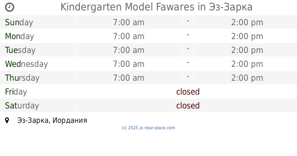
Kindergarten Model Fawares
Az-Zarqa
School
read more
11.973 km
Kindergartens and secondary schools renaissance boys
Az-Zarqa
School
read more
13.167 km
مدارس فرسان القيم
Army Street, Az-Zarqa
School
read more
13.274 km
School Medina
Az-Zarqa
School
read more
13.657 km
Academy schools and kindergartens decision makers
Az-Zarqa
School
read more
15.02 km
مركز مكاني جمعية الرصيفة للتنمية
لواء الرصيفة،, Russayfah
School
read more
15.256 km
روضة المسبحين الاسلامية
Russayfah
School
read more
15.561 km
Fatima Zahra Secondary School for Girls
School
read more
15.633 km
مدرسة فجر الصباح الجبل الشمالي
Russayfah
School
read more
📑
all categories
Accounting
Administrative area level 1
Administrative area level 2
Airport
Amusement park
Aquarium
Art gallery
Atm
Bakery
Bank
Bar
Beauty salon
Bicycle store
Book store
Bowling alley
Bus station
Cafe
Campground
Car dealer
Car rental
Car repair
Car wash
Cemetery
Church
City hall
Clothing store
Colloquial area
Convenience store
Country
Courthouse
Dentist
Department store
Doctor
Electrician
Electronics store
Embassy
Finance
Fire station
Florist
Food
Funeral home
Furniture store
Gas station
General contractor
Grocery or supermarket
Gym
Hair care
Hardware store
Health
Home goods store
Hospital
Insurance agency
Jewelry store
Laundry
Lawyer
Library
Liquor store
Local government office
Locality
Locksmith
Lodging
Meal delivery
Meal takeaway
Mosque
Movie rental
Movie theater
Moving company
Museum
Natural feature
Neighborhood
Night club
Painter
Park
Parking
Pet store
Pharmacy
Physiotherapist
Place of worship
Plumber
Point of interest
Police
Post office
Premise
Real estate agency
Restaurant
Route
Rv park, camping
School
Shoe store
Shopping mall
Spa
Stadium
Storage
Store
Supermarket
Taxi stand
Train station
Travel agency
University
Veterinary care
Zoo
sublocality level 1
↑