Point of interest nearby ملعب الجامعة
Jordan
Point of interest nearby ملعب الجامعة
ملعب الجامعة
Damascus Highway, Az-Zarqa Израиль
contacts phone
:
+962
Latitude:
32.058829
, Longitude:
36.153915
read more
nearest Point of interest
206 m
Faculty of Graduate Studies
15, Az-Zarqa
Point of interest
read more
206 m
Scientific Faculties
15, Az-Zarqa
Point of interest
read more
206 m
Humanities Faculties
15, Az-Zarqa
Point of interest
read more
206 m
Health Faculties
15, Az-Zarqa
Point of interest
read more
249 m
مبنى الفاروق
Az-Zarqa
Point of interest
read more
262 m
رئاسة الجامعة
Az-Zarqa
Point of interest
read more
384 m
Leqaa FM
Az-Zarqa
Point of interest
read more
399 m
Zarki Beledium
Az-Zarqa
Point of interest
read more
5.233 km
Al Majd City
Zarqa, Qasabah District, Az-Zarqa
Point of interest
read more
5.338 km
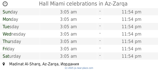
Hall Miami celebrations
Az-Zarqa
Point of interest
read more
5.457 km
Omar Alawna Auto Glass
Az-Zarqa
Point of interest
read more
5.603 km
Jordan Water Company Miyahuna
Az-Zarqa
Point of interest
read more
5.717 km
مختبر ابن رشد الطابق 2
Az-Zarqa
Point of interest
read more
5.728 km
Beloved water
Az-Zarqa
Point of interest
read more
5.789 km
مقهى 4 You
Az-Zarqa
Point of interest
read more
5.793 km
الصعيدي لتجهيز الكسارات 2
Az-Zarqa
Point of interest
read more
5.81 km
Razan Tailoring
Az-Zarqa
Point of interest
read more
5.811 km
Jordanian Association omens social charity to care for orphans
Az-Zarqa
Point of interest
read more
5.898 km
الدفاع المدني المنطق الحره الزرقاء
Az-Zarqa
Point of interest
read more
5.998 km
شركة الاولى للصناعات المتخصصه
Az-Zarqa
Point of interest
read more
6.03 km
مركز البترواوي الثقافي
Az-Zarqa
Point of interest
read more
6.281 km
Golden Security
Jordan، Zarqa، Free Zone
Point of interest
read more
6.45 km
سكوب للخلويات
Army Street, Amman
Point of interest
read more
6.546 km
SASNO MOBILE
Unnamed Road, Az-Zarqa
Point of interest
read more
6.581 km
جمعية ابناء اللد الخيرية
Az-Zarqa
Point of interest
read more
📑
all categories
Accounting
Administrative area level 1
Administrative area level 2
Airport
Amusement park
Aquarium
Art gallery
Atm
Bakery
Bank
Bar
Beauty salon
Bicycle store
Book store
Bowling alley
Bus station
Cafe
Campground
Car dealer
Car rental
Car repair
Car wash
Cemetery
Church
City hall
Clothing store
Colloquial area
Convenience store
Country
Courthouse
Dentist
Department store
Doctor
Electrician
Electronics store
Embassy
Finance
Fire station
Florist
Food
Funeral home
Furniture store
Gas station
General contractor
Grocery or supermarket
Gym
Hair care
Hardware store
Health
Home goods store
Hospital
Insurance agency
Jewelry store
Laundry
Lawyer
Library
Liquor store
Local government office
Locality
Locksmith
Lodging
Meal delivery
Meal takeaway
Mosque
Movie rental
Movie theater
Moving company
Museum
Natural feature
Neighborhood
Night club
Painter
Park
Parking
Pet store
Pharmacy
Physiotherapist
Place of worship
Plumber
Point of interest
Police
Post office
Premise
Real estate agency
Restaurant
Route
Rv park, camping
School
Shoe store
Shopping mall
Spa
Stadium
Storage
Store
Supermarket
Taxi stand
Train station
Travel agency
University
Veterinary care
Zoo
sublocality level 1
↑