Point of interest nearby محل ابراهيم نجادات للخلويات
Jordan
Point of interest nearby محل ابراهيم نجادات للخلويات
محل ابراهيم نجادات للخلويات
Aqaba Governorate, ירדן
contacts phone
:
+962 7 7554 1400
Latitude:
29.8005038
, Longitude:
35.3105836
larger map & directions
read more
nearest Point of interest
751 m
محطة معرفة القويرة
سورة
Point of interest
read more
902 m
محكمة صلح القويرة
Point of interest
read more
1.176 km
مركز دفاع مدني القويره
Point of interest
read more
3.131 km
شركة الولاء لخدمات الاعاشة
Point of interest
read more
3.505 km
Tesla Supercharger
Point of interest
read more
3.532 km
Alanya Cafe
Point of interest
read more
8.029 km
QUWEIRA 103MWp PV POWER PLANT
Point of interest
read more
8.993 km
Alqoirh solar station
Point of interest
read more
9.038 km
Al-Quwayrah Solar Substation
Point of interest
read more
9.257 km
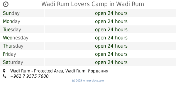
Wadi Rum Lovers Camp
Wadi Rum - Protected Area, Wadi Rum
Point of interest
read more
9.469 km
Al-Quwayrah Substation
Point of interest
read more
16.044 km
Union trucks in force
Rashidiyah
Point of interest
read more
17.03 km
Beit Ali Lodge Camp
Wadi Rum Road, Shakaria
Point of interest
read more
17.239 km
Rum Nabatean Camp
Wadi Rum Road, Shakaria
Point of interest
read more
17.655 km
French Fortres
Wadi Rum Village
Point of interest
read more
17.896 km
مركز دفاع مدني الشاكريه
Point of interest
read more
18.483 km
Jabal Rum Camp
Wadi Rum Desert, Wadi Rum
Point of interest
read more
21.542 km
Wadi Rum Tours Style
77110, Wadi Rum Road, Wadi Rum Village
Point of interest
read more
26.348 km
Deeseh Knowledge Station
Disah
Point of interest
read more
27.051 km
Hotel Captain Desert Camp
Wadi Rum
Point of interest
read more
28.466 km
Caravan Camping
Aqaba, Wadi Rum, Aqaba
Point of interest
read more
29.665 km
جمعية الديسه الزراعيه
Point of interest
read more
33.066 km
Manaseer Concrete Products
Aqaba
Point of interest
read more
33.211 km
Right To Play International Aqaba
Aqaba
Point of interest
read more
33.782 km
Modern Aluminum Systems CO
Aqaba
Point of interest
read more
📑
all categories
Accounting
Administrative area level 1
Administrative area level 2
Airport
Amusement park
Aquarium
Art gallery
Atm
Bakery
Bank
Bar
Beauty salon
Bicycle store
Book store
Bowling alley
Bus station
Cafe
Campground
Car dealer
Car rental
Car repair
Car wash
Cemetery
Church
City hall
Clothing store
Colloquial area
Convenience store
Country
Courthouse
Dentist
Department store
Doctor
Electrician
Electronics store
Embassy
Finance
Fire station
Florist
Food
Funeral home
Furniture store
Gas station
General contractor
Grocery or supermarket
Gym
Hair care
Hardware store
Health
Home goods store
Hospital
Insurance agency
Jewelry store
Laundry
Lawyer
Library
Liquor store
Local government office
Locality
Locksmith
Lodging
Meal delivery
Meal takeaway
Mosque
Movie rental
Movie theater
Moving company
Museum
Natural feature
Neighborhood
Night club
Painter
Park
Parking
Pet store
Pharmacy
Physiotherapist
Place of worship
Plumber
Point of interest
Police
Post office
Premise
Real estate agency
Restaurant
Route
Rv park, camping
School
Shoe store
Shopping mall
Spa
Stadium
Storage
Store
Supermarket
Taxi stand
Train station
Travel agency
University
Veterinary care
Zoo
sublocality level 1
↑