Pharmacy nearby Rawhi Pharmacy
Jordan
Pharmacy nearby Rawhi Pharmacy
Rawhi Pharmacy
B867, Queen Alia Airport St, Amman, JO Иордания
contacts phone
:
+962 6 445 3213
Latitude:
31.721718
, Longitude:
35.9862061
larger map & directions
read more
nearest Pharmacy
121 m
Pharmacy 1
Queen Alia International Airport, Queen Alia Airport St C867, Amman
Pharmacy
read more
298 m
Pharmacy 1 south pier
Queen Alia Airport Road, Amman
Pharmacy
read more
396 m
Phamacy One
Amman
Pharmacy
read more
3.851 km
صيدلية الجيزة الدولية
Amman
Pharmacy
read more
6.561 km
صيدلية القسطل الاولى - Qastal Pharmacy
Amman
Pharmacy
read more
13.489 km
Cocamela Manufacturing
Unnamed Rd, Jordan
Pharmacy
read more
13.496 km
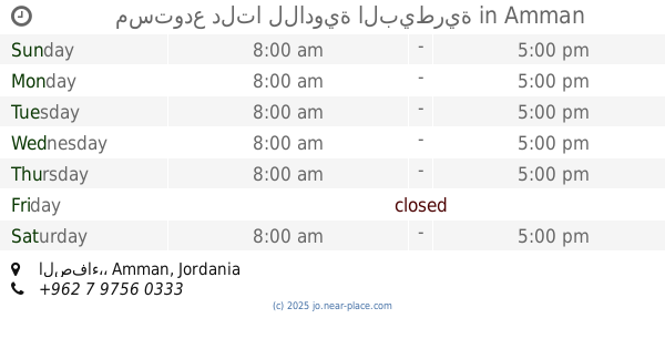
مستودع دلتا للادوية البيطرية
الصفاء،, Amman
Pharmacy
read more
13.724 km
Ahmed Store For Vet.Drugs
شارع مادبا،، عمّان
Pharmacy
read more
14.139 km
Pharmacy Gulls Veterinary
Madaba Highway, Amman
Pharmacy
read more
14.512 km
صيدلية نبع زمزم
Hizam Ring Road, Amman
Pharmacy
read more
14.535 km
لافندر جل الغسيل
Amman
Pharmacy
read more
14.535 km
لافندر
Hizam Ring Road, Amman
Pharmacy
read more
14.687 km
صيدلية اليمامة
النقيرة،, Amman
Pharmacy
read more
14.904 km
Alfareed Pharmacy
Amman
Pharmacy
read more
14.966 km
Eskan Al Sayadela Pharmacy
Da'san Commercial Complex, Madaba St 325, Amman
Pharmacy
read more
15.22 km
صيدلية نيازي
شارع جاوا،، عمّان
Pharmacy
read more
15.313 km
ZEBAQ PHARMACY
Amman
Pharmacy
read more
15.337 km
Mercury Pharmacy
Amman
Pharmacy
read more
15.46 km
Pharmacy Aserat
Amman
Pharmacy
read more
15.721 km
Al Yadoodeh Pharmacy
Rmada Center, Madaba St 268, Amman
Pharmacy
read more
15.936 km
Shadia Pharmacy
Complex No 254, Madaba St 254, Amman
Pharmacy
read more
16.171 km
Al Sabah Pharmacy
Complex No 6, Aisha Bint Talhah St 6, Amman
Pharmacy
read more
16.223 km
Pharmacy 1
Jamal Plaza Gas Station, Queen Alia Airport St 568, Amman
Pharmacy
read more
18.932 km
صيدلية أسامة وزينة
ش. مأدبا الغربي،, Amman
Pharmacy
read more
19.008 km
Khazneh Pharmacy
Complex No 120, Madaba Al Gharbi St 120, Naour
Pharmacy
read more
📑
all categories
Accounting
Administrative area level 1
Administrative area level 2
Airport
Amusement park
Aquarium
Art gallery
Atm
Bakery
Bank
Bar
Beauty salon
Bicycle store
Book store
Bowling alley
Bus station
Cafe
Campground
Car dealer
Car rental
Car repair
Car wash
Cemetery
Church
City hall
Clothing store
Colloquial area
Convenience store
Country
Courthouse
Dentist
Department store
Doctor
Electrician
Electronics store
Embassy
Finance
Fire station
Florist
Food
Funeral home
Furniture store
Gas station
General contractor
Grocery or supermarket
Gym
Hair care
Hardware store
Health
Home goods store
Hospital
Insurance agency
Jewelry store
Laundry
Lawyer
Library
Liquor store
Local government office
Locality
Locksmith
Lodging
Meal delivery
Meal takeaway
Mosque
Movie rental
Movie theater
Moving company
Museum
Natural feature
Neighborhood
Night club
Painter
Park
Parking
Pet store
Pharmacy
Physiotherapist
Place of worship
Plumber
Point of interest
Police
Post office
Premise
Real estate agency
Restaurant
Route
Rv park, camping
School
Shoe store
Shopping mall
Spa
Stadium
Storage
Store
Supermarket
Taxi stand
Train station
Travel agency
University
Veterinary care
Zoo
sublocality level 1
↑