Mosque nearby مسجد الابراهيمي
Jordan
Mosque nearby مسجد الابراهيمي
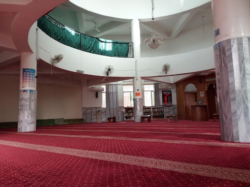
مسجد الابراهيمي
منطقة النصر،، Amman, ירדן
contacts phone
:
+962
Latitude:
31.9599572
, Longitude:
36.0178416
larger map & directions
read more
nearest Mosque
1.061 km
Righteous mosque.
Amman
Mosque
read more
1.289 km
مسجد رياض الصالح
Amman
Mosque
read more
1.404 km
Othman Bin Afan Mosque
Unnamed Road, Amman
Mosque
read more
1.698 km
Masjed Al Rawdah
Amman
Mosque
read more
1.765 km
Salahuddin Grand Mosque Ayoubi
Amman
Mosque
read more
1.811 km
Taiba Mosque
Amman
Mosque
read more
1.866 km
Abed Mosque validity
Amman
Mosque
read more
1.889 km
Reza mosque parents
Amman
Mosque
read more
1.904 km
Paradise mosque
Amman
Mosque
read more
1.944 km
مسجد الأخوة
Amman
Mosque
read more
1.977 km
Annasuh mosque
Amman
Mosque
read more
2.235 km
مسجد جنة الابرار
Amman
Mosque
read more
2.367 km
Abuzar Ghafari mosque
Amman
Mosque
read more
2.441 km
مسجد خزيمة بن ثابت الأنصاري
Amman
Mosque
read more
2.477 km
Abdullah Khalaf Mosque
Amman
Mosque
read more
2.544 km
مسجد معاذ بن جبل
Ein Al-Basha Street, Amman
Mosque
read more
2.598 km
مسجد الريان
At-Tatwir Street, Amman
Mosque
read more
2.723 km
مسجد عمرو بن العاص
Amman
Mosque
read more
2.766 km
مسجد جوهرة الإيمان
Amman
Mosque
read more
2.836 km
مسجد خليل الرحمن ماركا
Fatemah Al-Zahraa Street, Amman
Mosque
read more
2.918 km
مسجد عبد المعطي زلوم
Amman
Mosque
read more
3.08 km
مسجد خديجة أبو عليان
Amman
Mosque
read more
3.233 km
Khalid ibn al-Walid Mosque
Amman
Mosque
read more
3.402 km
Chapel Muhammad (peace be upon him) *
Amman
Mosque
read more
3.653 km
مسجد المستشفى العسكري
Al Malik Abdullah, Amman
Mosque
read more
📑
all categories
Accounting
Administrative area level 1
Administrative area level 2
Airport
Amusement park
Aquarium
Art gallery
Atm
Bakery
Bank
Bar
Beauty salon
Bicycle store
Book store
Bowling alley
Bus station
Cafe
Campground
Car dealer
Car rental
Car repair
Car wash
Cemetery
Church
City hall
Clothing store
Colloquial area
Convenience store
Country
Courthouse
Dentist
Department store
Doctor
Electrician
Electronics store
Embassy
Finance
Fire station
Florist
Food
Funeral home
Furniture store
Gas station
General contractor
Grocery or supermarket
Gym
Hair care
Hardware store
Health
Home goods store
Hospital
Insurance agency
Jewelry store
Laundry
Lawyer
Library
Liquor store
Local government office
Locality
Locksmith
Lodging
Meal delivery
Meal takeaway
Mosque
Movie rental
Movie theater
Moving company
Museum
Natural feature
Neighborhood
Night club
Painter
Park
Parking
Pet store
Pharmacy
Physiotherapist
Place of worship
Plumber
Point of interest
Police
Post office
Premise
Real estate agency
Restaurant
Route
Rv park, camping
School
Shoe store
Shopping mall
Spa
Stadium
Storage
Store
Supermarket
Taxi stand
Train station
Travel agency
University
Veterinary care
Zoo
sublocality level 1
↑