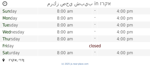
Health nearby Health Center Falah
Coronavirus disease (COVID-19) Situation
confirmed cases
1746997
deaths
14122
Jordan
Health nearby Health Center Falah
Health Center Falah
Ar-Rusajfa, Jordania
contacts phone
:
+962
Latitude:
32.0388471
, Longitude:
36.0575175
larger map & directions
read more
nearest Health
513 m
عيادات عليان الطبية
Unnamed Road, Russayfah
Health
read more
528 m
عيادات عليان الطبيه
Unnamed Road, Russayfah
Health
read more
532 m
عيادات عليان الطبيه
لواء الرصيفة،, Russayfah
Health
read more
975 m
مركز صحي تطوير الحضري
Russayfah
Health
read more
1.151 km
مركز أسامة بن زيد لرعاية الأحداث
Russayfah
Health
read more
1.302 km
Health center
8th Circle, Amman
Health
read more
1.407 km
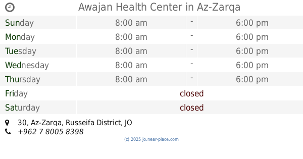
Awajan Health Center
30, Az-Zarqa
Health
read more
1.682 km
مركز صحي الامير حمزة الشامل
Az-Zarqa
Health
read more
1.713 km
Abu Basem Family
Russayfah
Health
read more
2.066 km
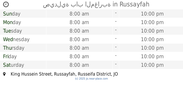
صيدلية باب المغاربة
King Hussein Street, Russayfah
Health
read more
2.07 km
مختبرات القدس التخصصية
Russayfah
Health
read more
2.316 km
Drug Energy Pharmacy
Russeifa District Ruseifa Russeifa District, Az-Zarqa
Health
read more
2.458 km
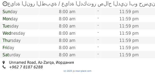
مركز دفاع مدني عوجان
Az-Zarqa
Health
read more
2.515 km
Hakim Medical Clinic
لواء الرصيفة،, Russayfah
Health
read more
2.668 km
عيادة النور الطبية / عيادة الدكتور صلاح الدين ابو حسين
Unnamed Road
Health
read more
2.729 km
عيادة الدكتور كميل عطاالله
Russayfah
Health
read more
2.794 km
عيادة الدكتور محمد شاتي والدكتورة فتحية بشر
Russayfah
Health
read more
2.825 km
Amriah Health Center
Russayfah
Health
read more
3.223 km
مركز صحي الزواهرة الاولي
Az-Zarqa
Health
read more
3.258 km
مركز صحي وادي الحجر الشامل
Az-Zarqa
Health
read more
3.272 km
صيدلية فيتامين
Az-Zarqa-alzohour street
Health
read more
3.654 km
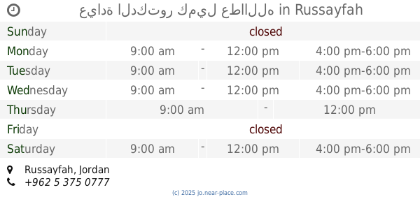
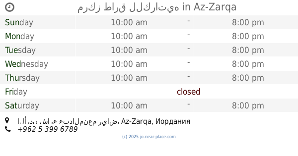
مركز صحي شبيب
Az-Zarqa
Health
read more
3.893 km
مركز طارق للكراتيه
الأردن شارع عبدالمنعم رياض
Health
read more
5.636 km
Dr. Mohammad Al Azzam clinic
Az-Zarqa
Health
read more
5.783 km
Medical Clinic soothes
Az-Zarqa
Health
read more
📑
all categories
Accounting
Administrative area level 1
Administrative area level 2
Airport
Amusement park
Aquarium
Art gallery
Atm
Bakery
Bank
Bar
Beauty salon
Bicycle store
Book store
Bowling alley
Bus station
Cafe
Campground
Car dealer
Car rental
Car repair
Car wash
Cemetery
Church
City hall
Clothing store
Colloquial area
Convenience store
Country
Courthouse
Dentist
Department store
Doctor
Electrician
Electronics store
Embassy
Finance
Fire station
Florist
Food
Funeral home
Furniture store
Gas station
General contractor
Grocery or supermarket
Gym
Hair care
Hardware store
Health
Home goods store
Hospital
Insurance agency
Jewelry store
Laundry
Lawyer
Library
Liquor store
Local government office
Locality
Locksmith
Lodging
Meal delivery
Meal takeaway
Mosque
Movie rental
Movie theater
Moving company
Museum
Natural feature
Neighborhood
Night club
Painter
Park
Parking
Pet store
Pharmacy
Physiotherapist
Place of worship
Plumber
Point of interest
Police
Post office
Premise
Real estate agency
Restaurant
Route
Rv park, camping
School
Shoe store
Shopping mall
Spa
Stadium
Storage
Store
Supermarket
Taxi stand
Train station
Travel agency
University
Veterinary care
Zoo
sublocality level 1
↑