Gas station nearby The Great Zoubia gas station
Coronavirus disease (COVID-19) Situation
confirmed cases
1746997
deaths
14122
Jordan
Gas station nearby The Great Zoubia gas station
The Great Zoubia gas station
Irbid Governorate, ירדן
contacts phone
:
+962
Latitude:
32.4170663
, Longitude:
35.7766128
larger map & directions
read more
nearest Gas station
5.955 km
Manaseer Ajloun Gas Station
55
Gas station
read more
6.401 km
كازية JO Petrol
Gas station
read more
6.425 km
Total Petrol Station
Ajloun
Gas station
read more
7.462 km
محطة المزار الشمالي
Gas station
read more
8.904 km
محطة وقود كفرعوان
Gas station
read more
8.922 km
محطة كفر عوان للمحروقات
Gas station
read more
11.436 km
كازية الزيزفونه
Gas station
read more
12.282 km
Al Fouad Petrol Station
Gas station
read more
12.407 km
محطة شاهين
Gas station
read more
12.443 km
Aydoun Gas Station
Gas station
read more
12.457 km
Urouba Gas Station
Der Abi Saeed
Gas station
read more
12.701 km
Gas station Naemeh
Gas station
read more
13.375 km
Ashour Gas Station
25
Gas station
read more
13.779 km
محطة بنزين JoPetrol
Irbid
Gas station
read more
14.227 km
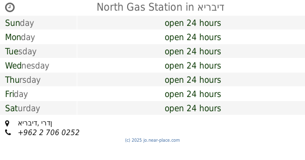
North Gas Station
Gas station
read more
14.227 km
محطة الشمال الحديثة للمحروقات
Bani Obeid District، Amman irbid highway، Irbid
Gas station
read more
14.81 km
محطة حموده لخدمة السيارات
Gas station
read more
14.864 km
محطة الفارس للمحروقات
Gas station
read more
15.21 km
Total Petrol Station
Irbid Qasabah District, Irbid
Gas station
read more
15.219 km
Total Gas Station
25, Aydoun
Gas station
read more
15.941 km
Jobtrul Petrol Station
Jerash
Gas station
read more
16.141 km
محطة الحكيم لخدمة السيارات
Al Hikmah, Irbid
Gas station
read more
16.817 km
Gulf Petrol Pump
Irbid
Gas station
read more
16.847 km
محطة توتال للمحروقات TOTAL Petrol Station
Irbid
Gas station
read more
18.421 km
محطة محروقات القيروان
شارع وصفي التل, Jerash
Gas station
read more
📑
all categories
Accounting
Administrative area level 1
Administrative area level 2
Airport
Amusement park
Aquarium
Art gallery
Atm
Bakery
Bank
Bar
Beauty salon
Bicycle store
Book store
Bowling alley
Bus station
Cafe
Campground
Car dealer
Car rental
Car repair
Car wash
Cemetery
Church
City hall
Clothing store
Colloquial area
Convenience store
Country
Courthouse
Dentist
Department store
Doctor
Electrician
Electronics store
Embassy
Finance
Fire station
Florist
Food
Funeral home
Furniture store
Gas station
General contractor
Grocery or supermarket
Gym
Hair care
Hardware store
Health
Home goods store
Hospital
Insurance agency
Jewelry store
Laundry
Lawyer
Library
Liquor store
Local government office
Locality
Locksmith
Lodging
Meal delivery
Meal takeaway
Mosque
Movie rental
Movie theater
Moving company
Museum
Natural feature
Neighborhood
Night club
Painter
Park
Parking
Pet store
Pharmacy
Physiotherapist
Place of worship
Plumber
Point of interest
Police
Post office
Premise
Real estate agency
Restaurant
Route
Rv park, camping
School
Shoe store
Shopping mall
Spa
Stadium
Storage
Store
Supermarket
Taxi stand
Train station
Travel agency
University
Veterinary care
Zoo
sublocality level 1
↑