Gas station nearby محطة ابو اسعد الداود الزعبي للمحروقات
Jordan
Gas station nearby محطة ابو اسعد الداود الزعبي للمحروقات
محطة ابو اسعد الداود الزعبي للمحروقات
א-רמת'א, ירדן
contacts phone
:
+962 7 9993 3745
Latitude:
32.5119934
, Longitude:
35.9760209
larger map & directions
read more
nearest Gas station
1.322 km
911 Station
Ramtha
Gas station
read more
1.601 km
Total
Ramtha
Gas station
read more
1.846 km
محطة أردن الحديثة للمحروقات
Ramtha
Gas station
read more
1.848 km
Modern Jordan Gas Station
Ramtha
Gas station
read more
3.086 km
University of Science Station
Ramtha
Gas station
read more
3.684 km
Al-Shayyab
Petra, Irbid
Gas station
read more
4.555 km
Alemyas Fuel Station
الحسن الصناعيه, Ramtha
Gas station
read more
5.113 km
Тотал
Ramtha, Amman
Gas station
read more
7.353 km
محطة توتال
Ramtha
Gas station
read more
7.701 km
North Gas Station
Gas station
read more
7.701 km
محطة الشمال الحديثة للمحروقات
Bani Obeid District، Amman irbid highway، Irbid
Gas station
read more
8.988 km
Sal fuel station
Sal
Gas station
read more
9.46 km
Ashour Gas Station
25
Gas station
read more
9.971 km
Bushra Gas Station
Bushra
Gas station
read more
10.489 km
Total Petrol Station
Irbid Qasabah District, Irbid
Gas station
read more
11.171 km
مركز اربد لخدمه غيار الزيت والبناشر
شارع بشرى،، إربد
Gas station
read more
11.248 km
محطة توتال للمحروقات TOTAL Petrol Station
Irbid
Gas station
read more
11.359 km
Gas Station nughayr
Gas station
read more
12.476 km
كراج العمري عمرالعمري
Irbid
Gas station
read more
12.641 km
Abu Bakr Petrol Station
Irbid
Gas station
read more
12.85 km
North Station Irbid
An-Nour Street, Irbid
Gas station
read more
13.553 km
Total
Irbid
Gas station
read more
13.595 km
Petrol Station محطة طبريا للمحروقات
Gas station
read more
15.28 km
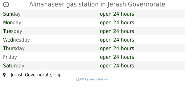
محطة المناصير جرش
Gas station
read more
15.286 km
Almanaseer gas station
Gas station
read more
📑
all categories
Accounting
Administrative area level 1
Administrative area level 2
Airport
Amusement park
Aquarium
Art gallery
Atm
Bakery
Bank
Bar
Beauty salon
Bicycle store
Book store
Bowling alley
Bus station
Cafe
Campground
Car dealer
Car rental
Car repair
Car wash
Cemetery
Church
City hall
Clothing store
Colloquial area
Convenience store
Country
Courthouse
Dentist
Department store
Doctor
Electrician
Electronics store
Embassy
Finance
Fire station
Florist
Food
Funeral home
Furniture store
Gas station
General contractor
Grocery or supermarket
Gym
Hair care
Hardware store
Health
Home goods store
Hospital
Insurance agency
Jewelry store
Laundry
Lawyer
Library
Liquor store
Local government office
Locality
Locksmith
Lodging
Meal delivery
Meal takeaway
Mosque
Movie rental
Movie theater
Moving company
Museum
Natural feature
Neighborhood
Night club
Painter
Park
Parking
Pet store
Pharmacy
Physiotherapist
Place of worship
Plumber
Point of interest
Police
Post office
Premise
Real estate agency
Restaurant
Route
Rv park, camping
School
Shoe store
Shopping mall
Spa
Stadium
Storage
Store
Supermarket
Taxi stand
Train station
Travel agency
University
Veterinary care
Zoo
sublocality level 1
↑